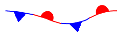
Cold Front - a zone separating two air masses,
of which the cooler, denser mass is advancing and replacing the warmer.
Warm Front
- a transition zone between a mass of warm air and the cold air it is replacing.
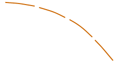
Stationary Front - a front between warm and cold air masses
that is moving very slowly or not at all.
Occluded Front - a composite of two fronts, formed as a
cold front overtakes a warm or quasi-stationary front. Two types of occlusions can form
depending on the relative coldness of the air behind the cold front to the air ahead
of the warm or stationary front. A cold occlusion results when the coldest air is behind
the cold front and a warm occlusion results when the coldest air is ahead of the warm front.
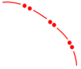
Trough - an elongated area of relatively low atmospheric
pressure; the opposite of a ridge. On WPC's surface analyses, this feature is also used to depict
outflow boundaries.
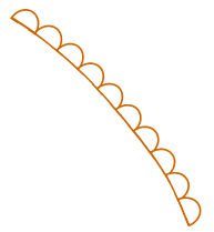
Squall Line
- a line of active thunderstorms, either continuous
or with breaks, including contiguous precipitation areas resulting from the existence of the thunderstorms.
Dry Line - a boundary separating moist and dry air masses. It
typically lies north-south across the central and southern high Plains states during the spring and early
summer, where it separates moist air from the Gulf of Mexico (to the east) and dry desert air from the
southwestern states (to the west).
Tropical Wave - a trough or cyclonic curvature maximum in the trade
wind easterlies.