Select NOAA-NWS Forecast Office Text Products
(Product availability varies with seasons, forecast office, and weather.)
Hazardous Weather Outlook for Boston/Taunton, MA
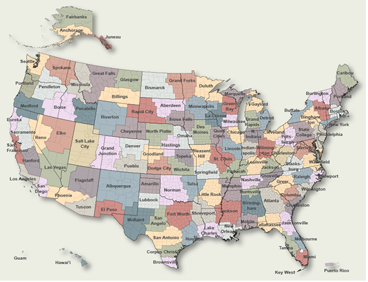
To Select Another NWS Office Click on Map or Choose from List
![]() |
Select Forecast Office: | Select Product: |
000 FLUS41 KBOX 030810 HWOBOX Hazardous Weather Outlook National Weather Service Boston/Norton MA 410 AM EDT Sat Jun 3 2023 MAZ007-015-016-019-022-024-040815- Eastern Essex MA-Suffolk MA-Eastern Norfolk MA-Eastern Plymouth MA- Barnstable MA-Nantucket MA- 410 AM EDT Sat Jun 3 2023 ...HIGH SURF ADVISORY IN EFFECT UNTIL 8 PM EDT THIS EVENING... This Hazardous Weather Outlook is for eastern Massachusetts, northeastern Massachusetts and southeastern Massachusetts. .DAY ONE...Today and tonight. Please listen to NOAA Weather Radio or go to weather.gov on the Internet for more information about the following hazards. High Surf Advisory. .DAYS TWO THROUGH SEVEN...Sunday through Friday. No hazardous weather is expected at this time. .SPOTTER INFORMATION STATEMENT... Spotter activation is not expected at this time. $$ MAZ013-014-017-018-020-021-023-RIZ002-004>008-040815- Western Norfolk MA-Southeast Middlesex MA-Northern Bristol MA- Western Plymouth MA-Southern Bristol MA-Southern Plymouth MA- Dukes MA-Southeast Providence RI-Eastern Kent RI-Bristol RI- Washington RI-Newport RI-Block Island RI- 410 AM EDT Sat Jun 3 2023 This Hazardous Weather Outlook is for eastern Massachusetts, southeastern Massachusetts, northern Rhode Island and southern Rhode Island. .DAY ONE...Today and tonight. No hazardous weather is expected at this time. .DAYS TWO THROUGH SEVEN...Sunday through Friday. No hazardous weather is expected at this time. .SPOTTER INFORMATION STATEMENT... Spotter activation is not expected at this time. $$ ANZ230>237-250-251-254>256-040815- Boston Harbor-Cape Cod Bay-Nantucket Sound-Vineyard Sound- Buzzards Bay-Rhode Island Sound-Narragansett Bay-Block Island Sound- Coastal waters east of Ipswich Bay and the Stellwagen Bank National Marine Sanctuary-Massachusetts Bay and Ipswich Bay- Coastal waters from Provincetown MA to Chatham MA to Nantucket MA out 20 nm- Coastal Waters extending out to 25 nm South of Marthas Vineyard and Nantucket- Coastal Waters from Montauk NY to Marthas Vineyard extending out to 20 nm South of Block Island- 410 AM EDT Sat Jun 3 2023 This Hazardous Weather Outlook is for Massachusetts and Rhode Island coastal waters. .DAY ONE...Today and tonight. No hazardous weather is expected at this time. .DAYS TWO THROUGH SEVEN...Sunday through Friday. No hazardous weather is expected at this time. .SPOTTER INFORMATION STATEMENT... Spotter activation is not expected at this time. $$ CTZ002>004-MAZ002>006-008>012-026-RIZ001-003-040815- Hartford CT-Tolland CT-Windham CT-Western Franklin MA- Eastern Franklin MA-Northern Worcester MA-Central Middlesex MA- Western Essex MA-Western Hampshire MA-Western Hampden MA- Eastern Hampshire MA-Eastern Hampden MA-Southern Worcester MA- Northern Middlesex MA-Northwest Providence RI-Western Kent RI- 410 AM EDT Sat Jun 3 2023 This Hazardous Weather Outlook is for northern Connecticut, central Massachusetts, eastern Massachusetts, northeastern Massachusetts, western Massachusetts and northern Rhode Island. .DAY ONE...Today and tonight. No hazardous weather is expected at this time. .DAYS TWO THROUGH SEVEN...Sunday through Friday. No hazardous weather is expected at this time. .SPOTTER INFORMATION STATEMENT... Spotter activation is not expected at this time. $$ For more information on upcoming hazardous weather, please see the Area Forecast Discussion on our webpage for the latest forecast thinking. There is also our Enhanced Hazardous Weather Outlook at www.weather.gov/box/ehwo For the latest updates...please visit our webpage at www.weather.gov/boston You can follow us on Facebook at www.facebook.com/NWSBoston You can follow us on Twitter at @NWSBoston |
Previous Hazardous Weather Outlooks may be found at
NWS Boston/Taunton, MA (BOX) Office Hazardous Weather Outlooks.
(Click 'Previous Version' there to view past versions successively.
Some may differ only in time posted.)
Products Courtesy of NOAA-NWS
NWS Information Parsing Script by Ken True at Saratoga Weather - WFO and Products Scripts by SE Lincoln Weather.
Mapping by Curly at Michiana Weather and by Tom at My Mishawaka Weather.